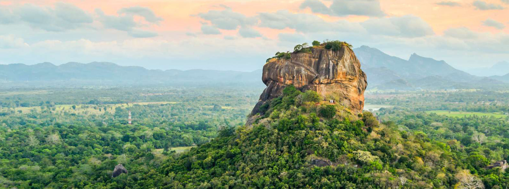
Sigiriya, a UNESCO World Heritage Site in Sri Lanka, is an ancient rock fortress and palace with stunning frescoes and extensive gardens. Rising dramatically from the plains, it's a testament to the island's rich history and architectural ingenuity. Explore the enchanting beauty and cultural significance of Sigiriya.
Sigiriya Reservoir, located near the iconic Sigiriya Rock Fortress, plays a significant role in Sri Lanka’s ancient hydraulic system and offers tourists a unique experience of both nature and history. This man-made reservoir was originally constructed during the reign of King Kashyapa in the 5th century and served as an essential part of the advanced water management system that supported the Sigiriya kingdom.
Tourists visiting the Sigiriya Reservoir can experience the serene beauty of the water body surrounded by lush greenery and scenic landscapes. The reservoir is especially beautiful during early morning and late afternoon, making it an ideal spot for photography enthusiasts looking to capture the reflection of Sigiriya Rock on the calm waters. This stunning backdrop creates an almost mirror-like effect, enhancing the natural beauty of the area.
The reservoir also offers boat rides, allowing visitors to appreciate the engineering marvel of this ancient structure while enjoying peaceful moments on the water. The boat ride provides panoramic views of the surrounding forests, distant mountains, and the towering Sigiriya Rock, giving tourists a unique perspective on the area’s historical and ecological importance.
Wildlife enthusiasts will appreciate the variety of bird species that can be observed around the reservoir. The water body attracts various aquatic birds, including herons, kingfishers, and egrets, making it a great location for birdwatching. The reservoir is also home to fish and other aquatic life, contributing to its biodiversity.
Additionally, the area around the reservoir offers opportunities for walking and nature trails, where tourists can explore the natural flora and fauna of the region. The combination of history, nature, and wildlife makes a visit to Sigiriya Reservoir a memorable experience, offering a tranquil escape that complements the grandeur of Sigiriya Rock.
The Central Province of Sri Lanka consists primarily of mountainous terrain. The province has an area of 5,674 km², and a population of 2,421,148. Some major towns include Kandy, Gampola (24,730), Nuwara Eliya and Bandarawela. The population is a mixture of Sinhalese, Tamil and the Moors.
Both the hill capital Kandy and the city of Nuwara Eliya are located within the Central Province as well as Sri Pada. The province produces much of the famous Ceylon tea, planted by the British in the 1860s after a devastating disease killed all the coffee plantations in the province. Central Province attracts many tourists, with hill station towns such as Kandy, Gampola, Hatton and Nuwara Eliya. Temple tooth or Dalada maligawa is the main sacred place in Centrel province.
The climate is cool, and many areas about 1500 meters often have chilly nights. The western slopes are very wet, some places having almost 7000 mm of rain per year. The eastern slopes are parts of the mid-dry zone as it is receiving rain only from North-Eastern monsoon. The Temperatures range from 24°C at Kandy to just 16°C in Nuwara Eliya, which is located 1,889 m above sea level. The highest mountains in Sri Lanka are located in the Central Province. The terrain is mostly mountainous, with deep valleys cutting into it. The two main mountain regions are the central massif and the Knuckles range to the east of Kandy.